


Lhagoi Kangri Mountain in Shigatse
Chinese Name:Lhagoi Kangri Mountain in Shigatse
English Name: 拉轨岗日山脉
Located in the southern part of Tibet, the Lhagoi Kangri belt is a heteroclite juxtaposition of sub-ranges squeezed between the Yarlung Tsangpo (Brahmaputra) river to the north and the High Himalaya to the south.
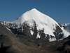
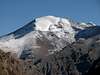
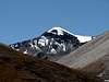
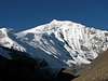
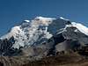
The eastern part of Lhagoi Kangri range is dominated by the huge massif of Noijin Kangsang (7206m), and counts around 30 main and subsidiary summits over the magic limit of 6’000m. Three mountains can be considered as major peaks, with a prominence (re-ascent height) of more than 1’400m. Five other main summits have a prominence between 400 and 600m.
Despite its proximity to Lhasa, the area has remained relatively unknown so far. Most expeditions concentrate on Noijin Kangsang, first climbed by a Chinese-Tibetan team in 1986, and which is now regularly offered by commercial operators. The second highest peak in the area, Kaluxung (6674m) was successfully climbed by a Japanese expedition in 2005 only, while several other 6’000m peaks are still unclimbed!
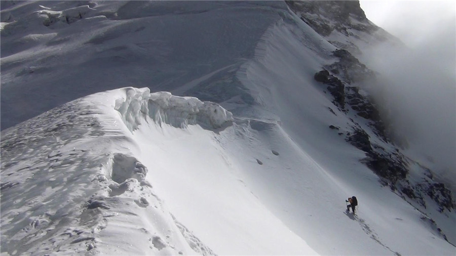
The area offers both non-technical glacier climbs, as well as more challenging climbs on steep faces and exposed ridges. As a general rule, north routes are usually heavily glaciated, while it is not uncommon to find steep scree slopes up to almost 6’000m on the southern side.
Thanks to its proximity to the main road connecting Lhasa to Gyantse, the area would represent an ideal objective for solo climbers or small groups without logistic support. Do consider however the red tape chapter below.
2. Geology and taxonomy

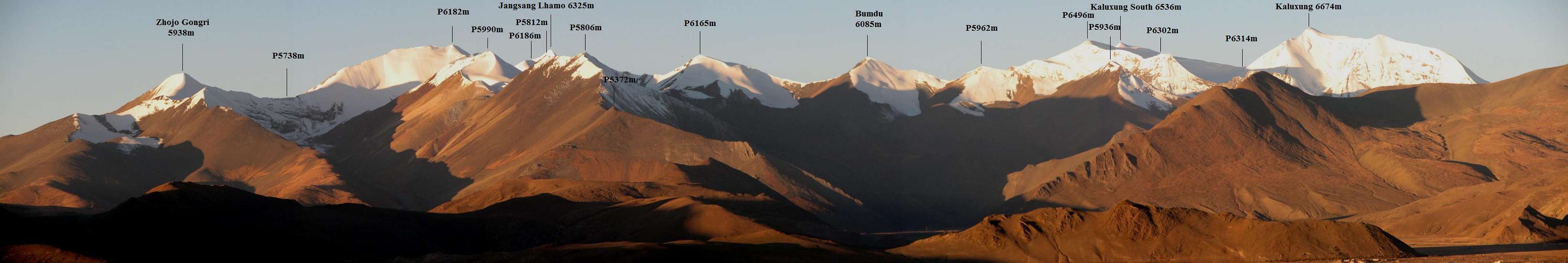
180° panorama (left = S, centre = W, right = N) of the Lhagoi Kangri East range, seen from Mt. Qunyang |
From North to South, the three plutonic belts in Southern Tibet are:
-
- Gandise (or Kangdese), also called Transhimalaya, located north of the Yarlung Tsangpo (Brahmaputra river) and south of the Tibetan plateau.
-
- Lhagoi Kangri, also called North Himalaya which lies between the High Himalaya and the Yarlung Tsangpo river.
- High Himalaya, which forms the southern border with Bhutan, India and Nepal. Four 8000ers (Chomolungma /Everest, Lhotse, Makalu and Cho Oyu) are located on the Tibet-Nepal border, while Shisha Pangma is the only 8000er fully inside Tibet.
All three belts are oriented more or less parallel in a East-West direction. Lhagoi Kangri was formed during the Cenozoic Era, with a core part consisting in metamorphic rocks such as gneiss, migmatite and metamorphic sand shale and slate.
This page describes the eastern part of Lhagoi Kangri belt, mainly the mountains around Karo La pass on the Gyantse-Nagartse road. This area is surrounded by Yamdrok Yumtso lake (east), Phuma Yumtso lake (south), Nyang Chu river tributaries (west) and Yarlung Tsangpo river (north).
Three main zones will be presented in this page: South of Karo La, North of Karo La, and North of Rong Chu River.
It has been difficult to find a convenient name for this area, as different authors might classify it under as many different names such as Bhutan Himalaya sub-range, Kangar Punzüm sub-system, Karo La group, or Noijin Kangsang area…
I finally opted for Lhagoi Kangri East, in reference to its geological origin, and in agreement to the name given by the Lanzhou Institute of Glaciology and Geocryology, which has edited the most accurate map of Noijin Kangsang area. However, it should not be confounded with Mt. Lhagoi Kangri (Hlako Kangri), a 6457m unclimbed peak located 250km further west.
3. Information available about the area
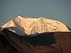
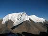
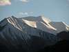
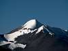
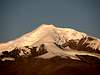
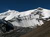
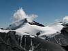
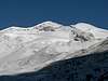
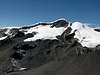
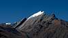
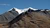
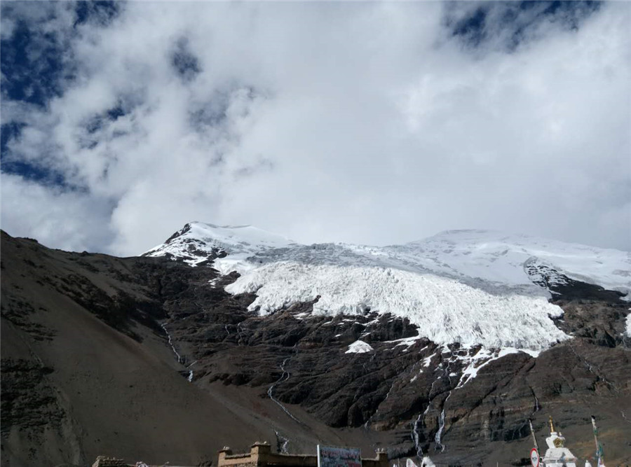
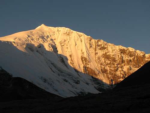 Noijin Kangsang (7206m), the highest peak in Lhagoi Kangri range
Despite its proximity with Lhasa and Shigatse (less than 200km from each town) and its convenient position on the main road Gyantse-Nagartse, very little information is available on the area.
The first climb of Noijin Kangsang dates back to 1986, but no other ascents have been reported on other peaks in the range until 2005, when Kaluxung was first climbed by a Japanese party. Chomo Kara, the third most prominent peak in the area, is still unclimbed.
Fortunately, a fairly accurate map of the area is existing in both Chinese and English versions, though the English spelling can be sometimes very approximate. However, a great confusion is reigning regarding some mountain names: Kaluxung is for example still often confused with its neighbours Jangsang Lhamo and Jetung Chusang (probably a deformation of Jagan Susong) and maps of the area name it alternatively Kaluxung or Kalurong. Noijin Kangsang can be found with as many as 12 different spellings, which are often the result of approximate phonetic translations from the Tibetan and/or Chinese name.
In order to establish some clarity between the different peaks in the range, I have tried to compile lists as exhaustive and accurate as possible, using a combination of the following sources of information:
a) 1:50’000 Noijin Kangsang map
b) Personal observation (GPS data)
c) Google Earth
d) High Asia Systematics list that can be downloaded at 8000ers.com.
Do note that GE data may have up to 3″ difference with GPS measures, and that altitudes given on the map are typically 5-25m lower than GPS readings.
4. The 16 highest peaks in the area with a prominence cut-off of 200m
(m) |
(m) |
(Lat / Lon) |
||
| 01 | 7206m | 2160m | Noijin Kangsang | 28°56’54.0″N 90°10’42.0″E |
| 02 | 6674m | 1458m | Kaluxung | 28°51’02.4″N 90°12’24.7″E |
| 03 | 6536m | 240m | Kaluxung South | 28°50’12.6″N 90°13’10.2″E |
| 04 | 6325m | 610m | Jangsang Lhamo / Jangsunglhomo | 28°48’58.8″N 90°16’46.2″E |
| 05 | 6249m | 420m | Gyalongsum / Jagang Susong | 28°48’19.7″N 90°13’14.4″E |
| 06 | 6212m | 390m | Qigu | 28°58’57.2″N 90°15’46.8″E |
| 07 | 6182m | 280m | P6182m | 28°49’44.9″N 90°18’29.1″E |
| 08 | 6161m | 200m | Unnamed Peak 6161m | 29°00’11.3″N 90°12’46.7″E |
| 09 | 6151m | 210m | Lungba | 29°01’40.8″N 90°12’03.9″E |
| 10 | 6140m* | 1434m | Chomo Kara I (NE) | 29°16’32.9″N 90°20’03.9″E |
| 11 | 6140m* | 430m | Chomo Kara II (SE) | 29°15’06.3″N 90°20’31.0″E |
| *For the exact altitude of Chomo Kara I and II, see explanations in the chapter “Peaks North of Rongchu River” | ||||
|---|---|---|---|---|
| 12 | 6126m | 340m | P6126m | 28°48’52.3″N 90°14’55.6″E |
| 13 | 6110m | 290m | Mengjiu Zhari | 28°56’22.7″N 90°15’54.3″E |
| 14 | 6106m | 290m | Naji Kangsha | 28°57’46.3″N 90°16’35.9″E |
| 15 | 6085m | 270m | Bumdu | 28°50’47.8″N 90°16’33.7″E |
| 16 | 6004m | 560m | Jitanzhoma | 28°51’43.9″N 90°08’07.4″E |
5. The 8 most prominent peaks in the area
(m) |
(m) |
(Lat / Lon) |
||
| 01 | 2160m | 7206m | Noijin Kangsang | 28°56’54.0″N 90°10’42.0″E |
| 02 | 1458m | 6674m | Kaluxung | 28°51’02.4″N 90°12’24.7″E |
| 03 | 1434m | 6140m* | Chomo Kara I (NE) | 29°16’32.9″N 90°20’03.9″E |
| 04 | 650m | 5868m | Kangba Dojo | 29°03’54.0″N 90°05’44.6″E |
| 05 | 610m | 6325m | Jangsang Lhamo / Jangsunglhomo | 28°48’58.8″N 90°16’46.2″E |
| 06 | 560m | 6004m | Jitanzhoma | 28°51’43.9″N 90°08’07.4″E |
| 07 | 440m | 6140m* | Chomo Kara II (SE) | 29°15’06.3″N 90°20’31.0″E |
| 08 | 420m | 6249m | Gyalongsum / Jagang Susong | 28°48’19.7″N 90°13’14.4″E |
6. General orientation
See the “Getting there” chapter for a detailed description of the different options to reach Lhagoi Kangri East. Basically, the range can be divided into three distinct subgroups:
a) Mountains South of Karo La
b) Mountains North of Karo La
c) Mountains North of Rongchu River
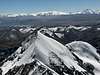
7. Mountains South of Karo La
Panorama of the mountains South of Karo La (distance 25km, looking SW) |
Peak list
(m) |
(Lat / Lon) |
(m) |
||
| 01 | 6674m | Kaluxung | 28°51’02.4″N 90°12’24.7″E | 1458m |
| 02 | 6536m | Kaluxung South | 28°50’12.6″N 90°13’10.2″E | 240m |
| 03 | 6496m | P6496m | 28°50’20.3″N 90°13’39.0″E | 30m |
| 04 | 6325m | Jangsunglhomo / Jangsang Lhamo | 28°48’58.8″N 90°16’46.2″E | 610m |
| 05 | 6302m | P6302m | 28°50’55.3″N 90°13’55.6″E | 30m |
| 06 | 6249m | Gyalongsum / Jagang Susong | 28°48’19.7″N 90°13’14.4″E | 420m |
| 07 | 6186m | P6186m | 28°49’25.8″N 90°17’21.6″E | 180m |
| 08 | 6182m | P6182m | 28°49’44.9″N 90°18’29.1″E | 280m |
| 09 | 6165m | P6165m | 28°50’00.6″N 90°16’50.3″E | 140m |
| 10 | 6126m | P6126m | 28°48’52.3″N 90°14’55.6″E | 340m |
| 11 | 6092m | P6092m | 28°51’29.6″N 90°13’58.2″E | 110m |
| 12 | 6085m | Bumdu | 28°50’47.8″N 90°16’33.7″E | 270m |
| 13 | 6004m | Jitanzhoma | 28°51’43.9″N 90°08’07.4″E | 560m |
| 14 | 5962m | P5962m | 28°51’20.0″N 90°16’30.0″E | 80m |
| 15 | 5938m | Zhojo Gongri | 28°49’36.1″N 90°20’1.1″E | 200m |
| 16 | 5936m | P5936 | 28°51’59.4″N 90°16’29.3″E | 110m |
Orientation
Most of the mountains South of Karo La are aligned in a east-west direction, following a sharp ridge.
The most convenient approach is from the North via the Gyantse-Nagartse road, as all peaks are located within a maximum distance of 10km from the road. Numerous short valleys lead straight from the road to the north glacier/ridge/face of the mountains.
The only important valley heading south is the Kara Pu. It is a wide valley providing good grassland for yaks and sheep. The valley, which is about 15km long, is flanked on the west by Kaluxung and on the east by Jitanzhoma. The 5444m high Doda La pass at the end of the valley is connecting Kara Pu with Quzong Pu valley.
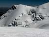
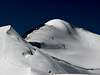
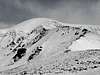
Gallery of peaks South of Karo La
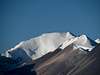
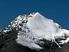
 Kaluxung N 6674m (NE)
 |
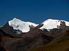
 Kaluxung N 6674m and S 6536m (W)
 |
 Kaluxung S 6536m and N 6674m (N)
 |
 Kaluxung S 6536m (N)
 |
 P6496m and Kaluxung S 6536m (NE)
 |
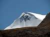
 Jangsang Lhamo 6325m (N)
 |
 P6302m (N)
 |
 P6302m (W)
 |
 Jagang Susong 6249m (N)
 |
 Jagang Susong 6249m (W)
 |
 P6186m (N-NE)
 |
 P6182m (N-NE)
 |
 P6182m (NE)
 |
 P6165m (E-NE)
 |
 P6165m (N-NE)
 |
 P6126m (NW)
 |
 P6092m (N-NE)
 |
 Bumdu 6085m and P5962m (N-NE)
 |
 Jitanzhoma 6004m (E)
 |
 Jitanzhoma 6004m (N)
 |
 Zhojo Gongri 5938m (N-NE)
 |
 Zhojo Gongri 5938m (NE)
 |
 P5936m (N)
 |
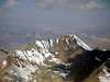
 P5816m (N)
 |
8. Mountains North of Karo La

Panorama of the mountains North of Karo La (eastern part of Nganyang Pu Valley) |
Peak list
(m) |
(Lat / Lon) |
(m) |
||
| 01 | 7206m | Noijin Kangsang | 28°56’54.0″N 90°10’42.0″E | 2160m |
| 02 | 6733m | Togolung (southwest summit of NK) | 28°55’56.8″N 90°09’28.5″E | 60m |
| 03 | 6570m | P6570m (southeast summit of NK) | 28°55’27.0″N 90°11’39.3″E | 120m |
| 04 | 6484m | Gama (along NK north ridge) | 28°58’24.7″N 90°11’02.3″E | 20m |
| 05 | 6222m | Dara (along NK north ridge) | 28°58’50.3″N 90°12’07.8″E | 30m |
| 06 | 6212m | Qigu (east of Nganyang valley) | 28°58’57.2″N 90°15’46.8″E | 390m |
| 07 | 6161m | Unnamed Peak 6161m (along NK north ridge) | 29°00’11.3″N 90°12’46.7″E | 200m |
| 08 | 6151m | Lungba (along NK north ridge) | 29°01’40.8″N 90°12’03.9″E | 210m |
| 09 | 6121m | Qunyang (north of Nganyang valley) | 29°00’10.0″N 90°14’08.5″E | 170m |
| 10 | 6110m | Mengjiu Zhari (east of Nganyang valley) | 28°56’22.7″N 90°15’54.3″E | 290m |
| 11 | 6106m | Naji Kangsha (east of Nganyang valley) | 28°57’46.3″N 90°16’35.9″E | 290m |
| 12 | 6095m | P6095m (along NK southeast ridge | 28°55’03.5″N 90°12’46.5″E | 120m |
| 13 | 6070m | Unnamed (along NK north ridge) | 29°01’05.2″N 90°12’06.8″E | 80m |
| 14 | 6064m | P6064m (along NK north ridge) | 28°59’34.6″N 90°12’09.4″E | 50m |
| 15 | 6026m | P6026m (east of Nganyang valley) | 28°56’47.0″N 90°16’45.7″E | 130m |
| 16 | 6024m | P6024m (east of Nganyang valley, foresummit of Qigu) | 28°59’41.0″N 90°15’15.5″E | 90m |
| 17 | 6016m | P6016m (east of Nganyang valley, foresummit of Qigu) | 28°59’03.7″N 90°15’16.9″E | 50m |
| 18 | 5868m | Kangba Dojo (north of Nyangmoxatan La) | 29°03’54.0″N 90°05’44.6″E | 650m |
Orientation
To the north of Karo La, there are two main valleys located on the western and eastern slopes of the pass. These two valleys are closed by high passes on their northern end, and the mountains described in this chapter are East of West of these two valleys.
- Langdu Xongju Valley (west of Noijing Kangsang):
Lagdu Xongju is a wide valley with extended grassland, which can be accessed heading north a few km below Karo La. Lagdu Xongju river is an affluent of Nyang Chu River, which flows through Gyantse up to Shigatse, where it converges with Yarlung Tsangpo (Brahmaputra). In its northern part, the valley forks in a “Y” shape, closed by two pass at 5352m (Nyangmoxatan La) and 5218m (Nyangrung La).The mountains west of the valley culminates at 5600-5700m and are not glaciated. The twin peak of Kangba Dojo (5868m) and Kanghu Lunpo (5811m), located further north from Nyangmoxatan La, are the highest peaks in the area, and slightly glaciated in their northern slopes.
To the west of the valley, the formidable Noijin Kangsang S-N ridge extends for more than 15km at an altitude over 6’000m. Along this ridge are located P6733m, P7206m, P6484m, P6222m, P6064m, P6161m, P6151m and P5922m. The whole N-S traverse would represent a real challenge, especially as the traverse between Noijin Kangsang (7206m) and Gama (6484m) has never been succeeded.
- Nganyang Pu Valley (east of Noijing Kangsang):
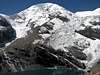
This relatively narrow valley is a tributary of the kalurong Qu river, which flows into Yamdrok Yumtso Lake.From the turn off on the Gyantse-Nagartse road (altitude 4710m, 9km below Karo La, or 19km above Nargartse), enter the valley northwards and follow the motorable track for about 4km until the small Kangbu Lamasery is visible uphill. Perched on a steep side valley, Kangbu lake (5124m) is nested at the end of the huge glacier of Noijing Kangsang southeast face.
Following the main valley northwards, you soon reach another small valley branching east towards the sharp peak of Mengju Zari (6610m), P6026m, Naji Kangsha (6106m) and Qigu (6212m).
2.5km further north, another side valley forks west, and leads to Noijin Kangsang BC located at 5300m at the foot of the spectacular north-east face.
The northern end of the valley is closed by a circus of several peaks over 6’000m, Dara (6222m), P6064m, Peak 6161m & Qunyang (6121m), and P6024m. The lowest saddle is at 5820m and is glaciated on its northern slopes, so the valley cannot be crossed without ice axe and crampons.
Wildlife is relatively abundant in Nganyang Pu Valley, and the Himalayan Blue Sheep (Pseudois nayaur) can often be spotted in herds of twenty or more animals.
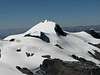
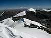
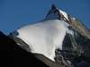
Gallery of peaks North of Karo La
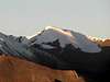
 Noijin Kangsang 7206m (NE)
 |
 Noijin Kangsang 7206m (E)
 |
 Noijin Kangsang 7206m and Togolung 6733m (W)
 |
 Noijin Kangsang 7206m, Togolung 6733m and P6570m (S)
 |
 P6570m (E)
 |
 Gama 6484m (E)
 |
 Dara (E)
 |
 Qigu 6212 (NW) and Naji Kangsha 6106m (NW)
 |
 Qigu 6212m (E)
 |
 Peak 6161m (S)
 |
 Peak 6161m (SE)
 |
 Peak 6161m (NE)
 |
 Lungba 6151m (S)
 |
 Qunyang 6121m (W)
 |
 Qunyang 6121m (SW)
 |
 Mengjiu Zhari 6110m (N)
 |
 Naji Kangsha (N)
 |
 P6026m (N)
 |
9. Mountains North of Rongchu River
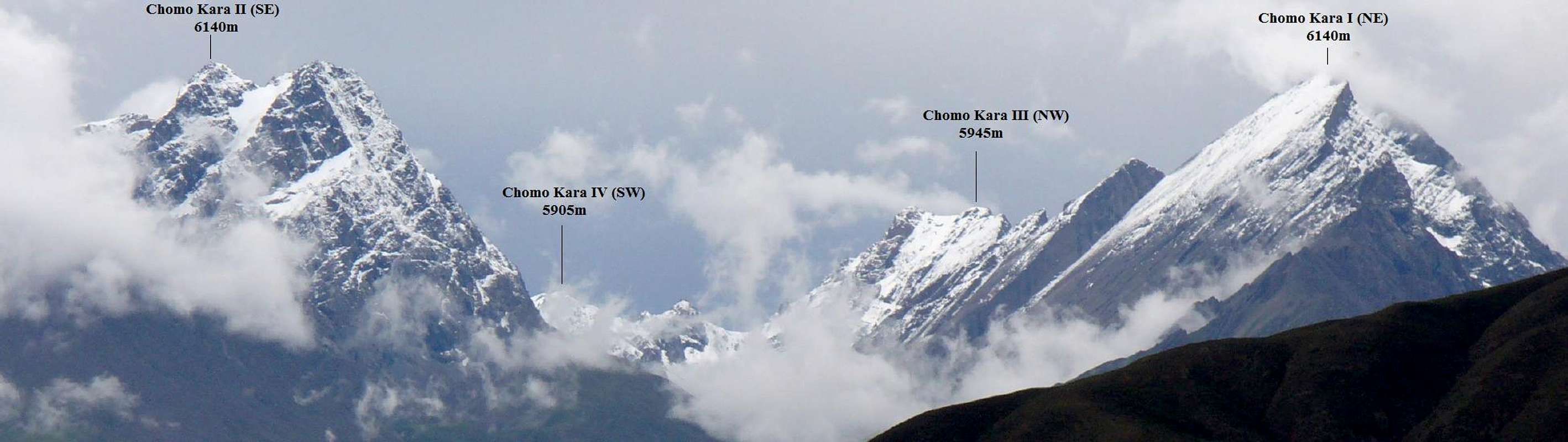
Panorama of the mountains North of Rongchu River – Chomo Kara massif (seen from the east) |
Peak list
(m) |
(Lat / Lon) |
(m) |
||
| 01 | 6140m (6073m) | Chomo Kara I (NE) | 29°16’32.9″N 90°20’03.9″E | 1434m |
| 02 | 6140m (6062m) | Chomo Kara II (SE) | 29°15’06.3″N 90°20’31.0″E | 430m |
| 03 | 5945m | Chomo Kara III (NW) | 29°15’58.4″N 90°18’29.9″E | 250m |
| 04 | 5905m | Chomo Kara IV (SW) | 29°14’54.0″N 90°18’57.4″E | 200m |
Note: only summits with at least 200m prominence have been considered in this list.
Remark on the altitude of Chomo Kara
It is not clear what is the true altitude of Chomo Kara (sometimes also named Xiemaguo or Shiemagon), and which summit is the highest point. According to 8000ers.com, Chomo Kara has an altitude of 6140m, and the coordinates correspond to the location of the SE peak. On GE, there highest point is the NE peak, with an altitude of approx. 6070m (instead of 6140m), while the SE peak is about 10m lower. In this page I have not been using GE as the primary source of information, but in the case of Chomo Kara it seems that GE might be more accurate: GE data are very consistent with a GPS measurement I took myself on a 4806m high pass located around 10km SW of the mountain. To estimate the prominence of Chomo Kara II, III and IV, I used GE as a reference, as the area is not covered in the 1:50:000 map of Noijin Kangsang.
Orientation
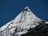
Chomo Kara is an extremely aesthetic mountain. With good weather, its two main peaks are clearly visible from Lhasa-Gongkar airport. The dramatic North faces of Chomo Kara I and II drop about 2500m directly into the Yarlung Tsangpo river (Brahmaputra) on its narrower part, where it builds a deep gorge. Unique in Tibet is also the smooth “slate-looking” south face of Chomo Kara II.
Chomo Kara is unclimbed and both NE and SE summits look very technical climbs. To add to the challenge, due to the uncertainty about which is the highest point, it would be safer to climb both summits in order to claim a first ascent!…
Geographically, Chomo Kara clearly belong to the eastern part of the Lhagoi Kangri range, but it is separated from the main massif of Noijin Kangsang (located around 30km S-SW) by the Rongchu river, which drains the waters of Yamdrok Yumtso lake.
Chomo Kara has a prominence of 1434m, and its parent mountain is not nearby Noijin Kangsang, but Yarlha Shampo located 170km away (southeast); the key saddle is 4706m high Charo La Pass (not to confuse with Karo La) on the northern side of Yamdrok Yumtso.
Chomo Kara can be accessed from three different sides:
a) From the East: follow the southern banks of Yarlung Tsangpo from the bridge at Chusual, until you reach the foot of the mountain
b) From the South: Starting point is the village of Pelde Dzong on the eastern shores of Yamdro Yumtso
c) From the West: Approach via Rinpung (see Getting there section).
Gallery of peaks North of Rongchu River
 Chomo Kara I and II (SE)
 |
 Chomo Kara I (E)
 |
 Chomo Kara I (E)
 |
 Chomo Kara II (E)
 |
 Chomo Kara III and IV (W)
 |
 Chomo Kara IV (W)
 |
10. Other 6’000er further East
It can be debated whether mountains further East do belong or not to the Lhagoi Kangri range. My opinion would be to include 6636m high Yarlha Shampo, as it located north of the watershed drained by Yamdrok Yumtso.
Yarlha Shampo has a very young climbing history: after a failed attempt in 2001, a Japanese team made the first ascent on 16 October 2007 via the North ridge.
Other peaks located further south such as Moinda Kangri (6425m, 28°26’06.”N 90°36’39″E) clearly do not belong to the Lhagoi Kangri belt, but should be ordered to the Bhutan Himalaya as part of the High Himalaya range.
Getting to Tibet
From mainland China to Tibet:
By train. Since the opening of the Qinghai-Tibet railway in 2006, train has become a very convenient and popular way to travel to Lhasa. The new line between Golmud and Lhasa crosses the Qinghai-Tibetan plateau in a 1142km journey, most of it above 4’000. At 5’072m, Tanggula is the highest railway pass in the world. Trains are very comfortable in both first class (soft sleeper) and second class (hard sleeper). Third class (hard seat) is much cheaper and also OK if you don’t mind sitting for quite a long time. During the peak season, trains are usually fully booked, so tickets need to be purchased as soon as they are on sale (usually 10 days in advance). There are currently direct trains to Lhasa from Beijing (47h), Chengdu (48h), Shanghai (49h), Guangzhou (56h) and Chongquing (47h). Trains can also be boarded on the way at Xi’an, Lanzhou, Xining or Golmud.
By road. Four main roads are connecting Tibet with Xinjiang, Qinghai, Sichuan and Yunnan Provinces. These roads can be officially travelled by organised tour groups only, but a good number of independent travellers and cyclists have succeeded to travel through.
Flying. Daily domestic flights to Lhasa from main Chinese towns (flights via Chengdu).
From Kathmandu (Nepal) to Lhasa:
Overland. Foreigners can enter Tibet at the Dram/Khasa/Zhangmu border only if they are member of an organised expeditions or tour group. The travel on the friendship highway to Lhasa offers fine view on Shisha Pangma (8027m), Cho Oyu (8201m) and Chomolangma (8848m).
Flying. Daily flight Kathamdu-Lhasa from spring till autumn. In winter, once or twice weekly.
Getting to the mountain
East approach: Lhasa – Nagartse – Karo La
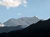
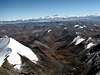
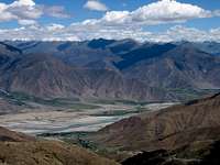 Yarlung Tsangpo Valley Yarlung Tsangpo Valley seen from Gampa La
 |
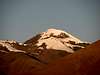
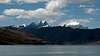
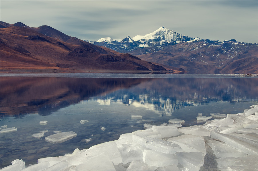
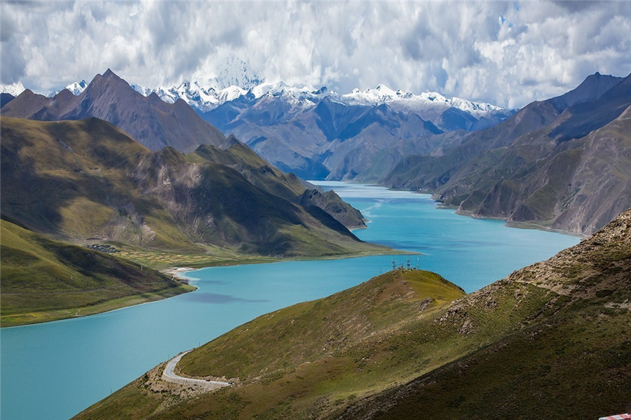
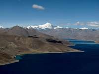 Panorama from Gampa La Panorama from Gampa La Yamdrok Yumtso with Noijin Kangsang
 |
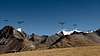
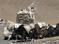 Yak Caravan Yak Caravan at Karo La (5036m)
 |
Karo La pass (5036m) represents the central point for the area described in this page. It is located on the main road between Nagartse and Gyantse, and also marks the border between Shigatse and Lhokha (Shannan) Prefecture.
The travel from Lhasa to Karo La is around 185km and takes 3-4 hours. You can hire a vehicle in Lhasa (Landcruiser is not needed) or take a bus from Lhasa to Nagartse, and then from Nagartse to Gyantse.
Leaving from Lhasa (3650m), the road first crosses Yarlung Tsangpo (Brahmaputra river) at Chusul, before climbing Gampa La (4800m), where there are fine views on Yamdrok Yumtso lake and the East Lhagoi Kangri range in the background. Noijin Kangsang is the highest peak rising above the lake. After passing the small town of Nagartse (4470m, several cheap hotels and restaurants), continue further up for about 28km until you reach Karo La pass (5036m)
West approach: Shigatse – Gyantse – Karo La
An approach from Shigatse through Gyantse is also possible, and is worth to be considered if you have just arrived in Lhasa and need a few more days for acclimation. Total distance From Shigatse to Karo La is 165km.
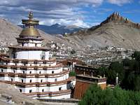
From Shigatse (3850m), head first to the historic town of Gyantse (92km), where it is worth visiting the unique 15th century Kumbum, a huge 9 storey stupa (chörten) which contains 75 chapel with several thousands of mural paintings.
In Gyantse, the road forks south to the Sikkim border, and west to the Karo La (73km). The intensive farming area along the Nyang Chu Valley gives gradually way to a more rugged landscape with increased elevation.
About 55km after leaving Gyantse, the W and SW flanks of Noijin Kangsang emerge from the wide grassland. On its final stretch towards Karo La along the Ngongtan River, the road passes right below the spectacular icefall of the Kara Glacier, dropping from Noijin Kangsang South Summit (6733m).
 Gyantse Gyantse Last town on the way to Karo La
 |
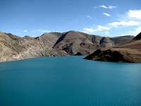 Turquoise lake Turquoise lake in the Nyang Chu valley
 |
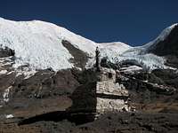 Kara Glacier Kara Glacier Approaching Karo La
 |
From the North: approach via Rinpung
Another possible approach to the range is via Rinpung (Ringpuk) county on the main road Lhasa-Shigatse, especially if you consider climbing Mt. Chomo Kara. Near the intersection for Nyemo County, leave the Friendship Highway (road marker KM 4750m) and cross the Brahmaputra River to enter the small Bartang Chu Valley. A small motorable road climbs up the valley up to a pass at 4806m (29°13’48.”N, 90°13’22″E), which offers fine views on the western side of Mt. Chomo Kara.
From the pass, the track turns west to some remote villages in the Rong Chu Valley. Before the road heads down again, Noijing Kangsang can be spotted to the South about 20 km away.
Red Tape
Do consider the red tape chapter below! As regulation for entering and travelling within Tibet can change rapidly, check travellers’ websites for updated information.
To enter China:
For most nationalities, tourist visa valid for 30 to 90 days are issued within a couple of days at Chinese Embassies and consulates abroad. Long duration visa (6-12 months) can often be obtained in Hong Kong. Tourist visa can be prolonged at local PSB (Public Security Bureau) twice for the duration of one month each time. However, it can be quite difficult to extend your visa within Tibet if you don’t have the corresponding Tibet Permit (see below), and if you are not part of a group.
To enter and travel within Tibet:
Foreigners need the following documents to enter and travel within Tibet:
Tibet Entry Permit (issued by Tibet Tourism Bureau)
Tibet Entry Permit is usually requested when you buy a train or flight ticket. Local travel agencies in Beijing or Kathmandu can arrange in a few days your Tibet Entry Permit together with your Train/Plane ticket to Lhasa.
Alien Travel Permit (issued by Public Security Bureau – PSB)
Lhasa and Shigatse cities, as well as a few tourist spots around Lhasa have been declared open to foreigners, so that you don’t need any additional permit anymore. However, as soon as you want to move into areas closed to foreigners, you need an Alien Travel Permit (ATP), which lists the places where you will be allowed to travel. Cost of an ATP is 50 RMB.
Climbing Permit (issue by China Tibet Mountaineering Association – CTMA)
Climbing fees are changing regularly, and mountains in Tibet are usually proposed within a package including transportation, logistics, entry permit, etc. The lump sum varies depending on the number of climbers, and bargain in possible depending on the service level you require.
Contact CTMA at the following address for more information:
China Tibet Mountaineering Association
No 8 East Linkhor Road
Lhasa, Xizang/Tibet, China
Tel: +86-891- 6333687
fax:+ 86-891- 6336366
e-mail: ctma@public.ls.xz.cn
Camping and accommodation
Nearest guesthouses can be found in Gyantse and Nagartse. Once in the mountains, you need to be self-sufficient, and there are plenty of beautiful camping spots.
Finding water is usually not a problem, except during winter when rivers and springs might be frozen at BC altitude, which means that you need to foresee enough fuel to melt ice.
When to climb
Spring (end of March till beginning of June) and autumn (end of September till beginning of November) are the best seasons to attempt the highest peaks in the range. Winter climbs are also possible, but you will need extremely warm equipment. Winds are usually stronger in spring than in autumn. Weather is instable during the summer rainy season (monsoon).
Gear and food
An increasing selection of mountaineering equipment can be found in Lhasa, but prices are rather expensive compared with Kathamdu or mainland China. Top Chinese brand, such as Ozark, SheHe, Toread have their own expensive shops on Beijing Road and North Lingkor Road, and cheaper fake stuff can be found on both Beijing road and Mentsikhang road near the Barkhor area.
Try the Tibetan owned Outlook Outdoor shop located on East Beijing Road, which is quite friendly and offers a fine selection of different brands.
In Shigatse, the Toread outdoor shop on Shanghai road is probably the best furbished for camping equipment, but don’t expect to find technical gear.
For food, Lhasa and Shigatse have plenty of well stocked markets and supermarkets, while the selection will be more limited in Gyantse and Nagartse.
Maps
Google Earth is a precious tool to plan an expedition to the Lhagoi Kangri range.
The Lhanzhou Institute of Glaciology and Geocryology has produced an excellent 1:50’000 map of Noijin Kangsang area, which is published by Xi’An Cartographic Publishing House (1997). The map exists in both Chinese and English versions. The names in the English version may slightly differ from the most commonly accepted names, but contour and altitudes seem to be quite accurate.
Unfortunately, the map is not distributed anymore (due to lack of sales, according to the publisher which I have contacted), so posting it on SP should rather be considered a favour than a copyright violation… Abroad, it may still be possible to order the map online at themapshop.co.uk or at mapsworldwide.com.
Source from: https://www.summitpost.org/lhagoi-kangri-east/503040


