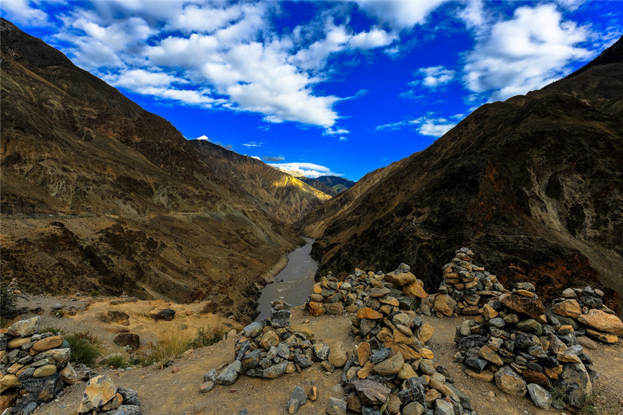
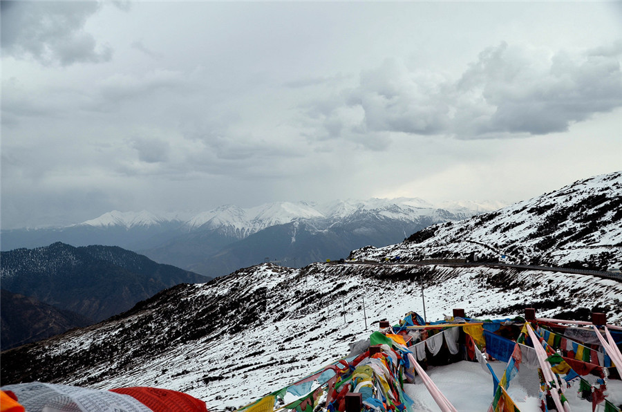
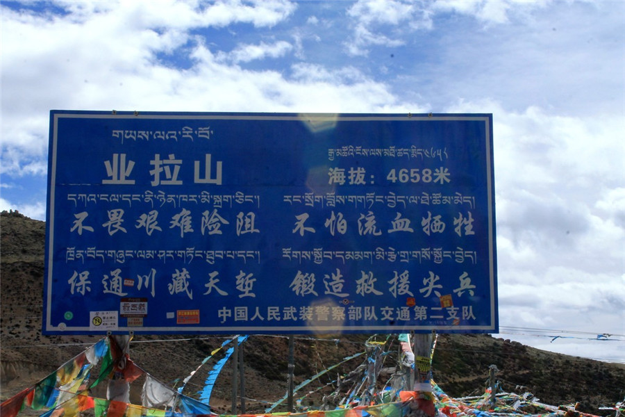
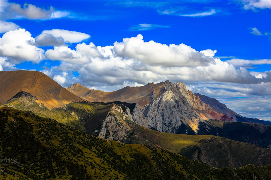
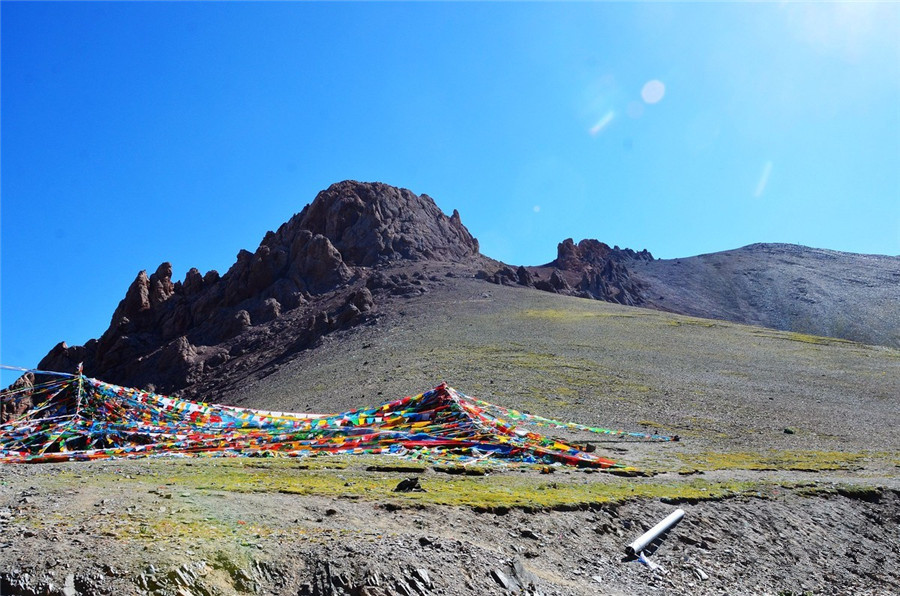
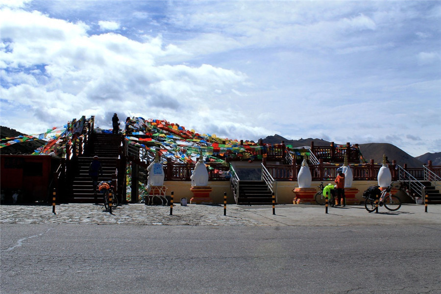
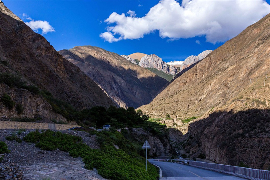
Yela Mountain Pass in Baxoi County, Chamdo
Yela Mountain Pass (业拉山口), also known as Nujiang Mountain Pass (怒江山垭口), is an important geographical feature located in Baxoi County (八宿县), Chamdo (昌都), Tibet. Situated on the G318 National Highway (川藏南线), it is famous for its perilous Nujiang 72 Turns (怒江72拐) mountain road. The pass is known for its steep terrain and dramatic scenery, making it a significant landmark on the route through the Tibetan Plateau and the Himalayas.
Geographic Location and Features
Geographical Position
-
Location: The Yela Mountain Pass is located along the G318 National Highway, connecting Banda Town (邦达镇) to Baxoi County (八宿县), with the pass itself situated at an elevation of approximately 4658 meters.
-
Mountain Range: The mountain belongs to the Hengduan Mountains (横断山脉), which forms the transition between the Tibetan Plateau (青藏高原) and the Southeast Himalayan ranges.
-
Coordinates: Latitude 30°03′ N, Longitude 97°34′ E.
-
Elevation: The pass itself is at 4641 meters, with some discrepancies in measurements ranging from 4658 meters to 5008 meters at the peak.
Topography and Geological Features
Yela Mountain is famous for its dramatic vertical drop of 2000 meters, which forms part of the Nujiang Grand Canyon (怒江大峡谷). This canyon is one of the steepest V-shaped valleys in southwest China, offering awe-inspiring views of both the natural landscape and the Nujiang River (怒江). The pass serves as a watershed between the Nujiang and Yuqiu rivers, marking a significant natural divide.
The geological features of the area are complex, with active fault zones creating frequent landslides and rock falls. The Nujiang 72 Turns, a series of sharp U-turns on the mountain road, includes over 100 hairpin bends, with the maximum vertical drop reaching 1400 meters in just 10 kilometers.
Road Features and Transportation
Nujiang 72 Turns
The road through Yela Mountain is notorious for its difficult curves, and it is widely known for the Nujiang 72 Turns. The winding section spans approximately 12 kilometers, with an elevation change of 1918 meters from the pass to the Nujiang Bridge (怒江大桥). The number of turns varies depending on the viewpoint, with estimates ranging from 72 to 108 sharp curves.
-
Slope: The road has extremely steep slopes, with some sections involving 360-degree blind turns, particularly dangerous during the winter due to snow and ice buildup.
-
Traffic: On average, there are about 17 traffic accidents per year on this section, especially during the rainy season from July to September.
Safety Tips for Driving
-
Driving Advice: When descending the pass, drivers should shift to a low gear to control their speed, with a recommended speed of less than 40 km/h. It is important to honk at sharp turns to warn other drivers.
-
Weather Precautions: During the rainy season, be aware of potential rock falls. In winter, carry snow chains for added safety.
Ecological Features
Vegetation and Wildlife
Yela Mountain features six distinct vertical vegetation zones:
-
Above 4600 meters: Alpine desert, covering less than 5%.
-
4200-4600 meters: Alpine meadow, primarily dominated by purple needlegrass (紫花针茅).
-
3800-4200 meters: Alpine shrub zone, home to golden currant (金露梅).
-
3000-3800 meters: Subalpine forest, including spruce (云杉) and fir (冷杉) trees.
-
2500-3000 meters: Arid river valley shrub zone.
-
Below 2500 meters: Dry, hot river valley grasslands.
Endemic Species
Unique plant species found in the area include Nujiang Rhodiola (怒江红景天) and Yela Green Gentian (Meconopsis yelaensis), both of which are endemic to the region.
Cultural Significance and Mythology
Sacred Sites and Legends
At the summit of Yela Mountain, there is a cave, known as “King Gesar’s Locking Demon Cave” (格萨尔王锁妖洞), where Tibetan legends say King Gesar (格萨尔王) sealed away demons. The cave has an 8.6-meter diameter and reaches a depth of 22 meters. Inside, there are 17 ancient rock paintings from the Tubo period (吐蕃时期), which have significant historical and cultural value.
Locals believe that on the 15th day of the 4th month of the Tibetan lunar calendar, pilgrims walk around the pass 13 times in a clockwise direction as part of a religious circumambulation.
Prayer Flags and Ceremonial Sites
At the pass, there is a large prayer flag installation with over 20,000 flags, spread across an area of 1200 square meters. The flags are arranged in the traditional five-color configuration (blue 36%, white 24%, red 18%, green 15%, yellow 7%). The flags represent the five elements of Tibetan Buddhist teachings and are a symbol of prayer and blessing.
A highway museum (318国道公路博物馆) is located on the eastern side of the pass, showcasing the original tools and blueprints used during the construction of the road in 1954.
Nearby Attractions
Bangda Grassland (邦达草原)
Before reaching Yela Mountain, travelers pass through the Bangda Grassland, an elevated plateau meadow at around 4300 meters, offering a scenic stop.
Nujiang Bridge (怒江大桥)
This 74-meter bridge spans the Nujiang River, situated at an elevation of 2730 meters and is an essential part of the G318 Highway.
Ranwu Lake (然乌湖)
Located 90 kilometers from Baxoi County, Ranwu Lake is famous for its glacial lake scenery, providing a peaceful respite for travelers.


