


Lhasa River in Tibet
Chinese Name: 拉萨河
English Name: Lhasa River in Lhunzhub County, Lhasa
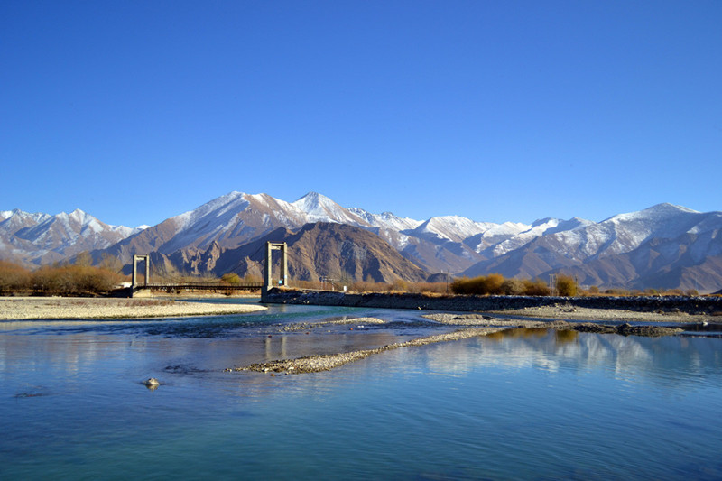
The Lhasa River, also called Kyi River (Tibetan: སྐྱིད་ཆུ་, Wylie: sKyid chu, Chinese: 拉薩河; pinyin: Lāsà hé), is a northern tributary of the Yarlung Tsangpo River in the south of the Tibet Autonomous Region of China. The Yarlung Tsangpo is the upper section of the Brahmaputra River. The Lhasa River is subject to flooding with the summer monsoon rains, and structures have been built to control the floods. In its lower reaches the river valley is an important agricultural area. The city of Lhasa, named after the river, lies on the river. There are two large hydroelectric power stations on the river, the Zhikong Hydro Power Station (100 MW) and the Pangduo Hydro Power Station (160 MW)
Basin[edit]
The Lhasa River drains an area of 32,471 square kilometres (12,537 sq mi), and is the largest tributary of the middle section of the Yaluzangbu River. The average altitude of the basin is around 4,500 metres (14,800 ft). The basin has complex geology and is tectonically active. Earthquakes are common. The river basin is the center of Tibet politically, economically and culturally. As of 1990 the population was 329,700, of whom 208,700 were farmers. 88% of the people were ethnic Tibetans.[2]
The climate is semi-arid monsoon, with a low average temperature of 1.2 to 7.5 °C (34.2 to 45.5 °F). Average annual precipitation is 466.3 millimetres (18.36 in), with 85% falling in the June-September period.[2] Annual runoff is 10,550,000,000 cubic metres (3.73×10¹¹ cu ft). Water quality is good, with little discharge of sewage and minimal chemical pesticides and fertilizers. The basin has about 35,258 hectares (87,120 acres) of farmland, of which 17,710 hectares (43,800 acres) is irrigated. There are 1,850,000 hectares (4,600,000 acres) of grasslands that may be used for pasturage, and 100,000 hectares (250,000 acres) of forest.[3]
Course[edit]
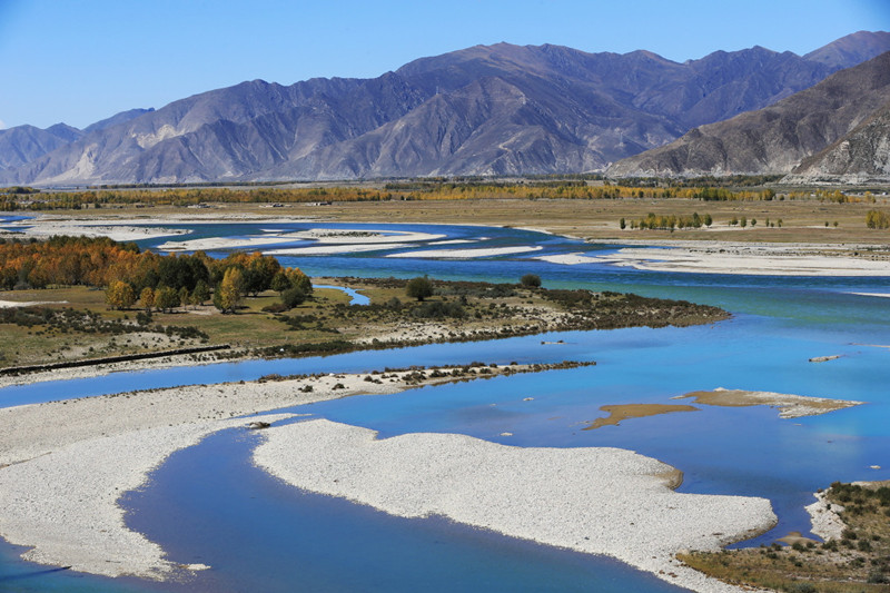
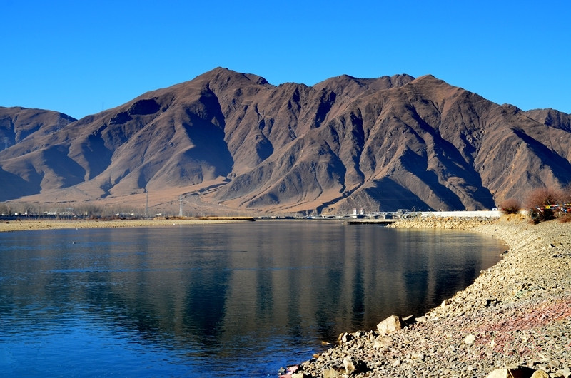
The Lhasa River is the longest of the Yarlung Tsangpo tributaries.[4] It flows through the south of the Tibet Autonomous Region of China, and is a left tributary of the Yarlung Tsangpo. It is about 450 kilometres (280 mi) long.[5] The river forms where three smaller rivers converge. These are the Phak Chu, the Phongdolha Chu which flows from Damxung County and the Reting Tsangpo, which rises beyond the Reting Monastery.[6] The highest tributary rises at around 5,290 metres (17,360 ft) on the southern slope of the Nyenchen Tanglha Mountains.[5][a] In its upper reaches the river flows southeast through a deep valley.[8]
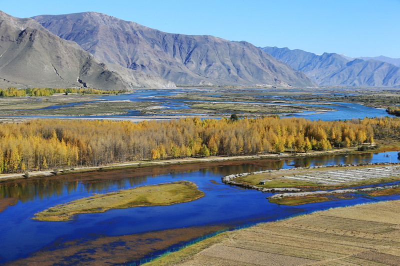
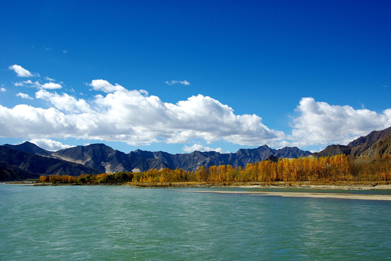
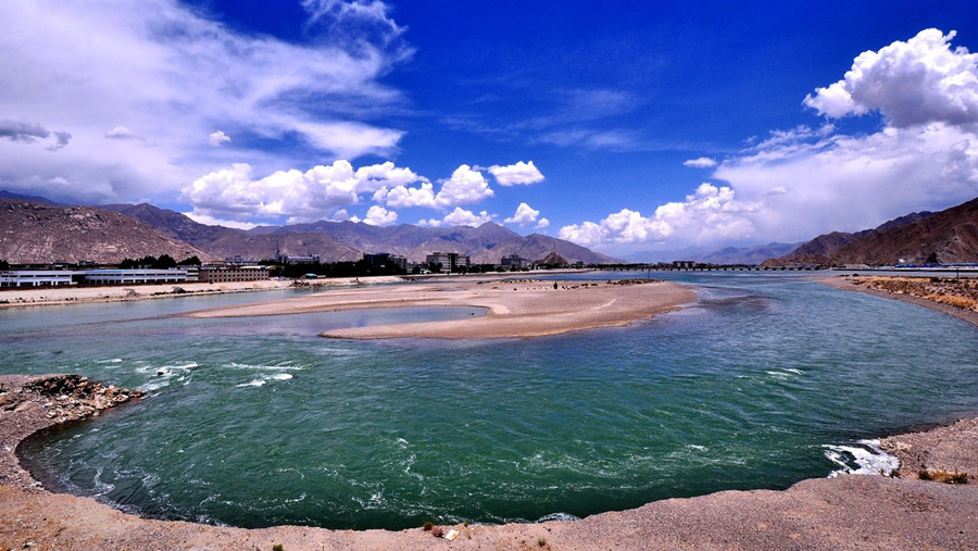
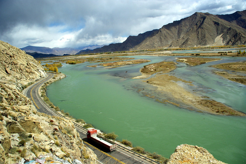
Lower down the river valley is flatter and changes its direction to the southwest, The river expands to a width of 150 to 200 metres (490 to 660 ft).[8] Major tributaries in the lower reaches include the Pengbo River and the Duilong River.[9] At its mouth the Lhasa Valley is about 3 miles (4.8 km) wide. It enters the Tsangpo at a point where that river makes a sharp turn to the south, and which therefore seems to be a continuation of the Lhasa River.[10] The river is navigable from its mouth on the Yarlung Tsangpo up to the city of Lhasa and to altitudes of up to 2,650 metres (8,690 ft).[8]
Intensive melting of snow and glaciers starts in May, contributing 20–30% of the water. The bulk of the water is supplied by the summer monsoon rains, which fall from July to September. There are floods in the summer from July to September, with about 17% of the annual runoff flowing in September.[b] In winter the river has low water, and sometimes freezes. Total flow is about 4 cubic kilometres (0.96 cu mi), with average flow about 125 cubic metres per second (4,400 cu ft/s).[8]
Fish population[edit]
The Lhasa River has mean monthly water temperatures that range from about 1 to 14 °C (34 to 57 °F).[12] Average water temperatures are 7.5 °C (45.5 °F).[13] There are abundant species of fish that are adapted to the clear and cool water.[4] The cool temperatures, with the upstream reaches above 4,000 metres (13,000 ft) freezing over at times, has the effect of delaying growth of fish such as Oxygymnocypris stewartii.[14] The Tibetan plateau has thin air and clouds, which combined with the clear water gives strong illumination from a full moon. This may affect the fishes’ circadian rhythm.[12] In 2009 it was reported that fish caught in the lower reaches of the river had been decreasing slightly in size, probably due to increasing demand and construction of hydroelectric dams.[15]
Settlements[edit]
Potala Palace, Lhasa from the east (1938)
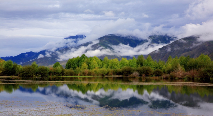
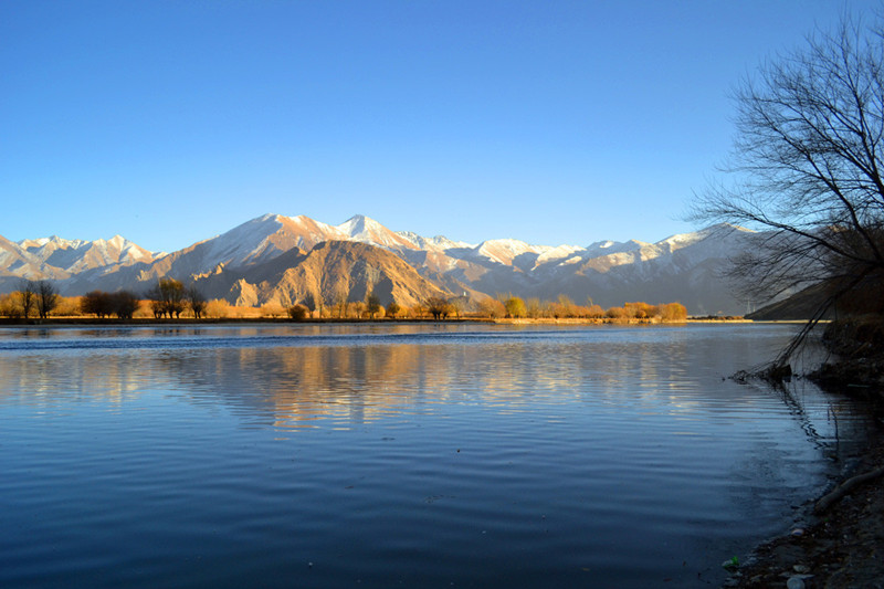
The river valley is one of the main agricultural areas of Tibet. The city of Lhasa lies on its shore, and there are many Buddhist monasteries in the valley.[16] Riwo Ganden Nampar Gyelpé Ling, the first fortress of the Gelukpa sect, was built on the left bank in 1409, about 35 miles (56 km) upstream from Lhasa. In 1416 the monastery of Chödra Chenpo Penden Drepung was built on the right bank near to the Neudzong fortress.[17] The ruins of the Sne’u rdzong fortress are on the left bank of the river, opposite the Norbulingka summer palace of the Dalai Lamas in Lhasa.[18]
The climate in the central river valleys of Tibet is comparatively mild. They are warm in summer, and even in the coldest months of winter the temperature is above freezing on sunny days.[19] A visitor described the valley around Lhasa in 1889 as follows,
The plain over which we are riding is a wonderfully fruitful one. It is skirted on the south by the Kyi river, and is watered, moreover, by another smaller stream from the north, which flows into the Kyi … some five miles west of Lhasa. All this land is carefully irrigated by means of dikes and cross-channels from both rivers. Fields of buckwheat, barley, pea, rape, and lindseed lie in orderly series everywhere. The meadows near the water display the richest emerald-green pasturage. Groves of poplar and willow, in shapely clumps, combine with the grassy stretches to give in places a parklike appearance to the scene. Several hamlets and villages, such as Cheri, Daru, and Shing Dongkhar, are dotted over these lands. A fertile plain truly for a besieging army![20]
Yutok Bridge in 1930
William Montgomery McGovern wrote in To Lhasa in Disguise (1924) that the right tributary of the Lhasa River, the Ti[c], which enters the river a few miles below Lhasa, was crossed by a very large and imposing bridge over a hundred yards long, with masonry piers and substantial stone embankments.[1]McGovern also described the Yutok-sampa, or Turquoise Bridge, a structure with walls and a roof that crossed what had been the main Lhasa River but was now a stagnant canal.[21] As late as 1984 kowas, yak hide boats similar to coracles, were being used to ferry passengers across the Lhasa River.[19]
The Liuwu Bridge was constructed across the Lhasa River to link central Lhasa to Lhasa Railway Station on the south bank.[22] The 1,600 metres (5,200 ft) bridge was completed in 2007.[23] In 2010 there was a small hydroelectric power station.[8] Prior to 2011, waste water from Lhasa was discharged untreated into the river. A waste water treatment plant designed to process 50,000 tons of sewage per day was commissioned in July 2011.[24]
Barrages[edit]
Before the incorporation of Tibet into the People’s Republic of China (1950–51), the agricultural engineer Peter Aufschnaiter designed a dam on the Lhasa River to protect the palace of Norbulingka in the city of Lhasa from flooding, with a water supply canal to the city. Heinrich Harrer monitored the work.[25]
In 1948 Heinrich Harrer had to intervene to reinforce a dyke that protected the Norbulingka from inundations by the Lhasa River, which was 2 kilometres (1.2 mi) wide after the monsoon. Harrer directed a work crew of 500 soldiers and 1,000 laborers paid by the government of Tibet. A fleet of 40 Yak skin boats were used to carry granite blocks extracted from a quarry upstream of the Norbulingka. Harrer mentions some difficulties. The Tibetans did not work as hard as westerners, and would stop to help worms when they found them. There were several hundred women working on the site. The soldiers did not fail to make jokes with them, to which they responded promptly. The site was often visited by members of the Tibetan government, who would give out silk scarves, and rewards were distributed to the workers.[26]
The total hydropower potential of the river basin is 2,560,000 kW.[3] 83 medium and small hydroelectric plants had been built by 1989, delivering a total of 26,124 kW.[9] Construction of the Zhikong Hydro Power Station in Maizhokunggar County began in May 2003.[27] The reservoir is at an elevation of 12,660 feet (3,860 m) above sea level.[28] The project cost 1.37 billion yuan. The dam impounds 225,000,000 cubic metres (7.9×10⁹ cu ft) of water. The 100 MW power station came into operation in September 2007.[29]
The Pondo Water-Control Project dammed the Lhasa River in Lhünzhub County. Work started in 2008, and progressed on schedule.[30] It is at an elevation of 13,390 feet (4,080 m) above sea level.[28] The project includes a reservoir and a power station with potential annual generating capacity of 599 million kilowatt hours.[31] The project, also called the Pangduo hydro project, impounds 1,170,000,000 cubic metres (4.1×10¹⁰ cu ft) of water.[32] It is planned to irrigate 435.2 square kilometres (168.0 sq mi). Damming of the river stream was completed in October 2011.[31] The project was due to start operating its first generator in October 2013. The project involved a total investment of 4.569 billion yuan, or about 0.74 billion US dollars, and has been called the “Tibetan Three Gorges”. It was built as part of the Western Development Strategy. The dam also supports flood prevention and water supply.[33
林周拉萨河_拉萨林周县林周拉萨河旅游指南
林周拉萨河
拉萨河藏语称“吉曲”,意为“快乐河”、“幸福河”,亦称“逻些川”、“克曲”、“机虔河”、“吉楚河”、“机楮河”、“吉特楚”、“藏江”。在拉萨市境内,位于西藏中南部。拉萨河发源于念青唐古拉山南麓嘉黎里彭措拉孔马沟,流经那曲、当雄、林周、墨竹工卡、达孜、城关、堆龙德庆,至曲水县。自源头始向西北流经彭措帕尔和鼓措卧玛两小湖,流人彭措。出彭措后称麦地藏布,至桑曲汇入口以上为上游;以下称热振藏布,至直孔为中游;直孔以下始称拉萨河,为下游段,至曲水县附近注入雅鲁藏布江。落差1620米,平均坡降2.9%。。径流补给以雨水为主约占48%,冰雪融水约占29%,地下水约占23%。是雅鲁藏布江中游一条较大的交流,全长495公里,流域面积31760平方公里,最大流量2830立方米/秒,最小流量20立方米/秒,年平均流量287立方米/秒。海拔高度由源头5500米到河口3580米,是世界上最高的河流之一,此河属于融雪和降雨类型,水量的大小随着温度的高低降水量的多少而变化。
拉萨河流域内大部分为山地,山峰高耸,坡度陡峭,地势自北向南倾斜,念青唐古拉山脉发育有规模不大的现代冰川。流域右岸支流大部发源于冰川,左岸支流大都发源于湖泊或沼泽,沿河两岸有河谷冲积平原,宽1—10公里,耕地面积约57万亩。这里气候温和,地势平坦,土质较厚,水源充沛,土质较好,是西藏主要粮食产区之一。
拉萨河在林周县唐古以上河谷呈“V”型,以下至墨竹工卡县河谷变宽阔,宽约1—1.5公里,开始有河心漫滩出现,漫滩上植被良好,该段河道较规正,两岸分布三级连续的阶地:三级阶地高出河水位40一50米,其表部为厚50一80厘米的砂表土,生长着茂盛的草类,是天然良好的牧场;二级阶地高出河水位20—30米;一级阶地高出河水位10—20米,大部分已被开垦成耕地。


Do you have arrange the rafting tour of Lhasa River?