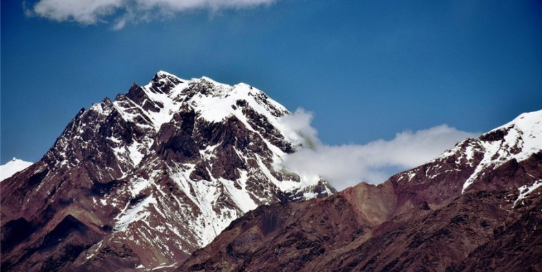
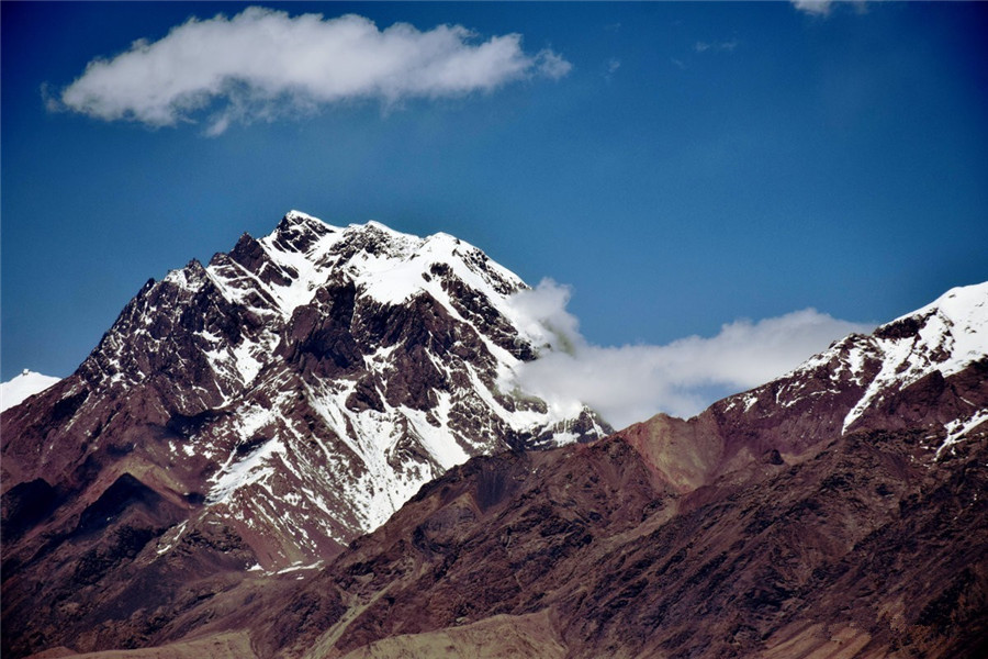
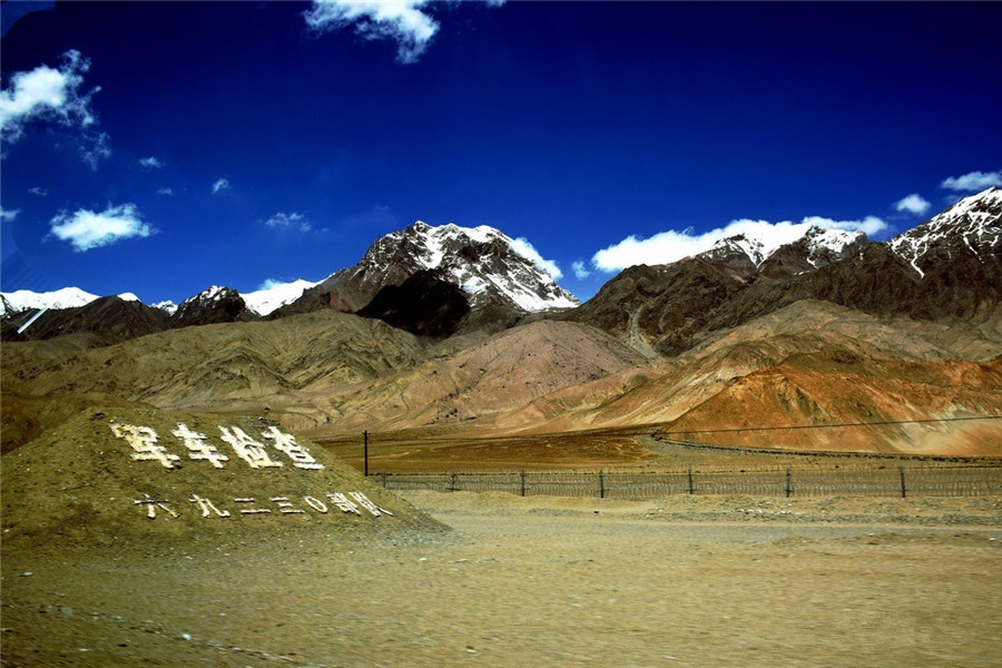
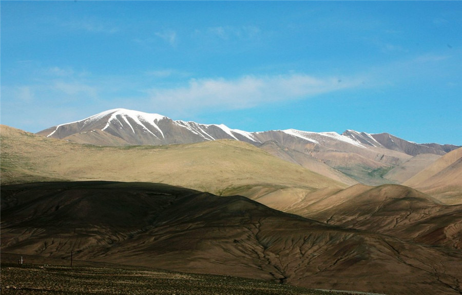
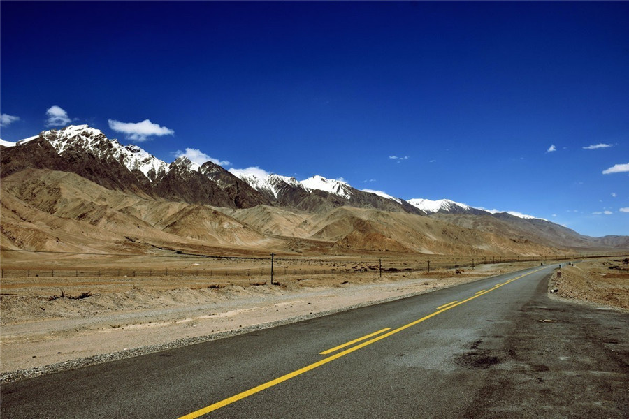
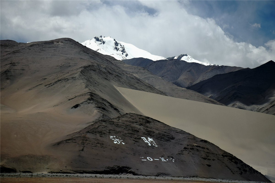
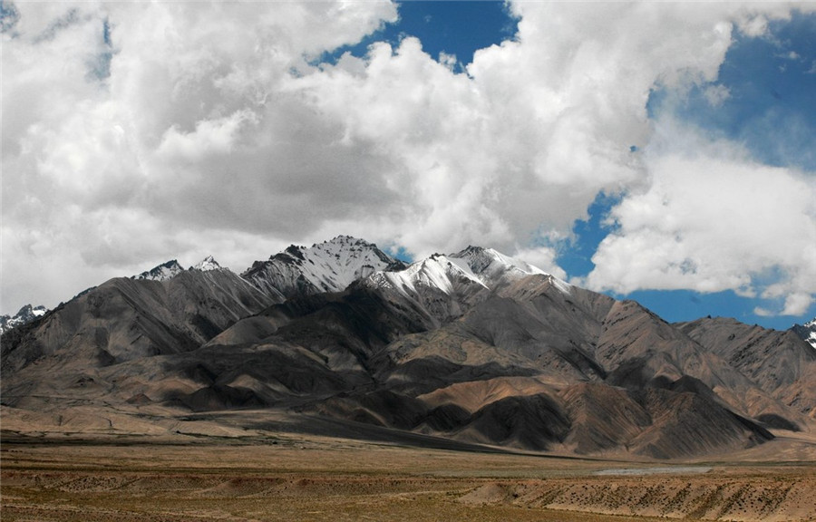
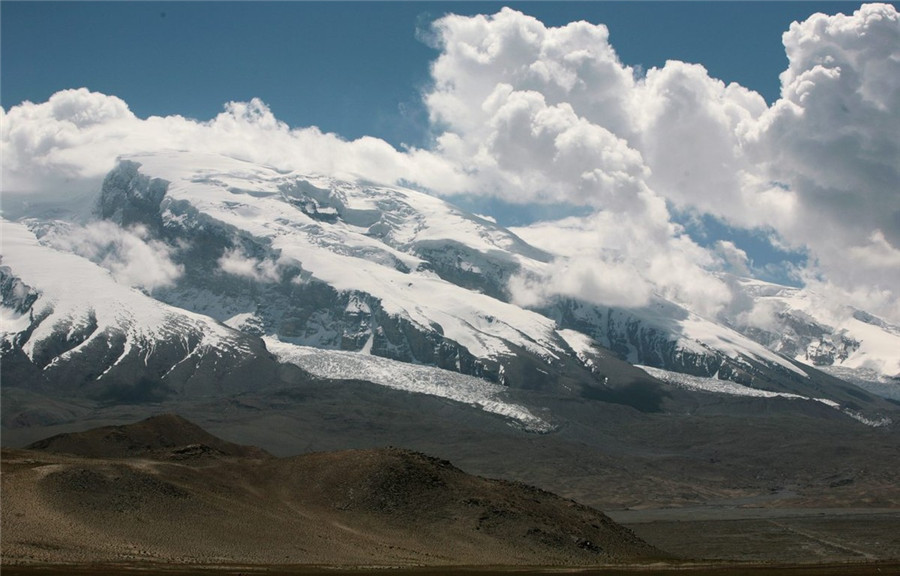
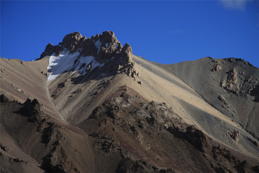
Karakoram Mountain Ranges in Xinjiang and Tibet

Karakoram Mountain Range (喀喇昆仑山脉), meaning “black rock mountain” in Turkic, is one of the most awe-inspiring mountain ranges in the world. It stretches approximately 480 kilometers from the eastern part of Afghanistan to the southeast, and spans about 240 kilometers in width and 800 kilometers in length. Known for its extreme altitude, the Karakoram has an average elevation of 5,500 meters (18,000 feet) above sea level, making it one of the most glaciated and mountainous regions outside the polar areas.

The name Karakoram is derived from the Turkic word for “black rock,” and while this term was introduced in early 19th-century English texts, it predates these writings in Turkic sources. The range forms a border between Tajikistan, China, Pakistan, Afghanistan, and India, giving it substantial geopolitical significance.

Geographical Features

Geological Structure

The Karakoram mountain range is a continuation of the Himalayas and Kunlun Mountains, with a series of parallel ridges and numerous offshoots. The core of the range is a solid mountain mass. Its total length, including the eastern extension into the Tibetan Plateau (西藏高原), reaches 800 kilometers, making it the longest mountain range in the region. The highest point in the range is K2 Peak (乔戈里峰) at an elevation of 8,611 meters (28,251 feet), making it the second highest mountain in the world.

The Karakoram range is defined by towering peaks, steep slopes, and vast glaciers. The southern slopes are longer and steeper, while the northern slopes are shorter and equally steep. The area is dotted with stone towers, sharp peaks, and glacial valleys. The area’s geological history is rooted in the collision of the Indian subcontinent with the Eurasian continent, which began during the Cretaceous period and continues today, causing ongoing tectonic activity in the region.

Climatic Conditions

The Karakoram experiences extreme climatic contrasts. Its vertical climatic zones vary from arid desert conditions in the lower valleys to glacial cold in the higher elevations. Precipitation is scarce on the lower slopes, with areas receiving less than 100 mm of rainfall annually. The south slopes benefit from moisture carried by the Indian Ocean monsoons, which bring heavy winter and spring precipitation. In contrast, the north slopes remain dry, receiving little to no rainfall.

Winter and spring bring the heaviest precipitation, while summer rains are sporadic. The region experiences intense solar radiation, with temperatures fluctuating wildly due to thin air and strong winds. The snowline on the south slope is around 4,694 meters (15,400 feet), and on the north slope, it starts at about 5,913 meters (19,430 feet).

Glaciers and Hydrology

The Karakoram is home to some of the world’s largest and most extensive glaciers. The southern slopes are particularly dominated by glacial activity, with glaciers descending to as low as 2,896 meters (9,500 feet). Notable glaciers include the Siachen Glacier and the Baltoro Glacier, both of which exceed 50 kilometers in length.

The glaciers of the Karakoram are essential for the Indian River System and the Tarim River System. These glaciers provide vital water sources for the rivers flowing through the region, and their meltwater feeds into major rivers like the Indus River (印度河) and Yarkand River (叶尔羌河).

Major Peaks of the Karakoram

The Karakoram Range is home to numerous towering peaks, many of which exceed 7,000 meters in elevation. Among the highest peaks are:

K2 Peak (乔戈里峰)

  • Standing at 8,611 meters (28,251 feet), K2 is the second-highest mountain in the world, behind only Mount Everest. It is located in Tashkurgan Tajik Autonomous County (塔什库尔干塔吉克自治县) in Xinjiang (新疆), China, on the border with Pakistan’s Kashmir region.

Broad Peak (布洛阿特峰)

  • Broad Peak rises to 8,051 meters (26,414 feet) and lies just east of K2. It is part of the quartet of peaks over 8,000 meters that dominate the central Karakoram region.

Gasherbrum I & II (加舒尔布鲁木峰 I & II)

  • These peaks stand at 8,080 meters (26,509 feet) and 8,028 meters (26,276 feet), respectively. They are part of a group of peaks that make the Karakoram a mecca for climbers.

Other Notable Peaks

  • Spantik Peak (斯潘德峰) — 7,385 meters (24,229 feet)

  • Masherbrum Peak (马舍布鲁姆峰) — 7,821 meters (25,659 feet)

These peaks, with their sharp ridgelines and immense glaciers, form a climber’s dream, drawing adventurers from around the world.

Local Flora and Fauna

The Karakoram Range is rich in biodiversity, with distinct ecological zones based on altitude and precipitation. The south slopes of the range, which receive more moisture, are covered with forests, while the north slopes are dry and barren.

Notable wildlife species in the region include:

  • Snow Leopards (雪豹)

  • Wild Yaks (野牦牛)

  • Tibetan Antelopes (西藏羚羊)

  • Marco Polo Sheep (马可波罗羊)

  • Himalayan Griffon Vultures (喜马拉雅秃鹰)

The region is also home to several endemic plant species and a variety of wildflowers. However, illegal hunting and overgrazing have diminished some populations, and conservation efforts are now in place to protect the endangered species of the Karakoram.

Inhabitants of the Karakoram

The Karakoram mountain range is sparsely populated due to its harsh natural conditions and difficult accessibility. The population is concentrated in small villages located along the valleys and in towns such as Gilgit and Skardu (吉尔吉特,斯卡都) in Pakistan, and Leh (列城) in Ladakh, India.

Inhabitants in this region are predominantly Shia Muslims, with many following the Ismaili or Twelver sects. The people of the Tashkurgan Tajik Autonomous County (塔什库尔干塔吉克自治县) are mainly Tajiks (塔吉克族), while other ethnic groups include Balti and Ladakhi people. These mountain communities engage in agriculture (growing barley, oats, and corn) and livestock farming (raising yaks, sheep, and goats).

Climbing the Karakoram

Best Time to Climb

  • The best climbing season for peaks like K2 and other Karakoram mountains is from May to early June, with the optimal climbing window between July and September when the weather conditions are more stable.

Climbing History

  • The Karakoram Range has long been a sought-after destination for mountaineers. K2 was first summited in 1954 by the Italian expedition led by Achille Compagnoni. However, climbing the range’s peaks is considered one of the most dangerous challenges in the world, with K2 having a particularly high death rate, earning it the nickname “Savage Mountain.”

The Karakoram continues to captivate adventurers and mountaineers worldwide, with new climbing routes still being explored on its daunting, ice-covered slopes.